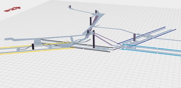
Andrew Godwin has just released an excellent mapping project, visualizing a few London Underground stations, complete with public corridors, escalators, spiral staircases and platforms. The maps are 3D models, which you can pan and zoom inside the browser. Digging into the source is also worth a look, since it uses some nice canvas and three.js guts.
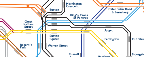
Poking around his other work, the Twin Tubes map is also worth a look - the underground network with each individual track visualized.